
Riverina
Powerful polar blast to bring multiple days of wind, rain, hail and snow
THE Riverina is bracing for a barrage of wintry weather, with a powerful polar blast set to sweep the region this weekend.
Back-to-back cold fronts will charge across southeast Australia, delivering a mix of wind, rain, thunderstorms, hail, snow, and bitterly cold daytime temperatures.
The first front is expected to arrive on Saturday, with rain likely to fall as snow over alpine areas through to at least Tuesday.
A second, colder front will follow on Sunday, dragging down temperatures even further and potentially bringing snow to lower elevations.
According to the latest forecast, snow could begin falling in the Bago State Forest near Batlow and Talbingo — about 30 minutes from Tumut — on Sunday, with flurries persisting into Monday.
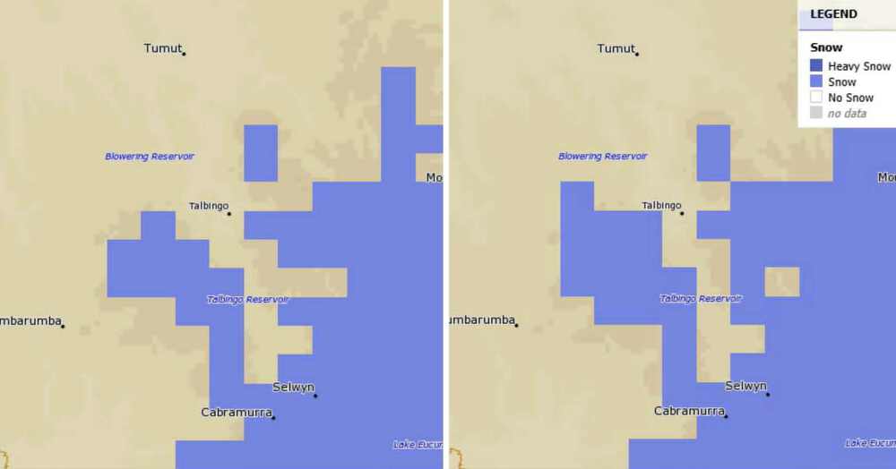
Forecast snowfall on Sunday, June 8 and Monday June 9 | Source: MetEye/Bureau of Meteorology
“It’s still too early to predict exactly how much snow will fall from these systems, although computer models suggest around 20 to 50 centimetres could fall across this four-day period,” Weatherzone meteorologist Ben Domensino said.
Rainfall totals of 10 to 25mm are expected across the Junee Shire, with daytime temperatures also remaining stubbornly low.
Junee is forecast to reach just 10°C on Monday, with a similarly chilly 11°C expected in Wagga and Temora.
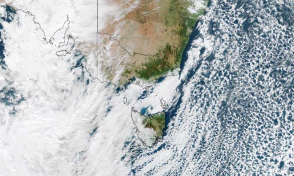
Satellite image showing the polar storm surging towards Australia’s southeast on Thursday | Source: Weatherzone
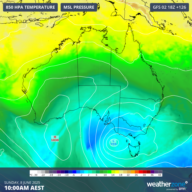
Image: Modelled 850 hPa temperature and mean sea level pressure (MSLP) showing cold air being driven over southeastern Australia on Sunday, June 8, 2025 | Source: Weatherzone
The incoming polar outbreak follows a frosty start to winter, with widespread sub-zero temperatures recorded across the Riverina on Thursday.
Towns across the region woke to heavy frosts, with apparent temperatures plunging as low as -7°C in some areas.
- READ MORE: Towns Shiver Through Deep Freeze


Wagga diesel drops below $3 as Junee gap widens

Motorists warned fuel tax cut will take time to hit the bowser

Junee servo backflips on diesel price as others hold steady


Pingback: Towns shiver through deep freeze as frosts blanket Riverina