
Local
Junee lashed by early morning hailstorm

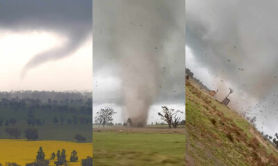
A HAILSTORM lashed parts of the Junee Shire on Saturday morning, leaving lawns, roads and rooftops peppered white in its wake.
The brief but intense storm cell developed west of Junee near Coolamon and Marrar around 8.30am and rapidly strengthening as it tracked east.
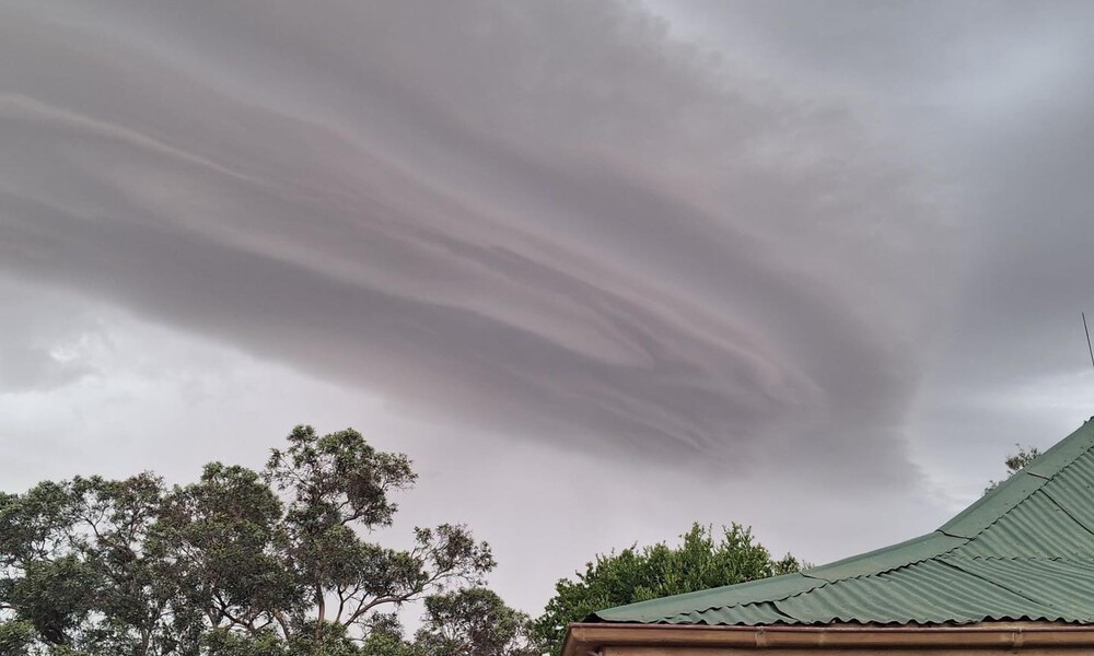
The storm moments before it slammed into Junee | Photo: Kathy Cook
By just after 9am, the system slammed into Junee at peak intensity, dumping marble-sized hail and heavy rain across the township.
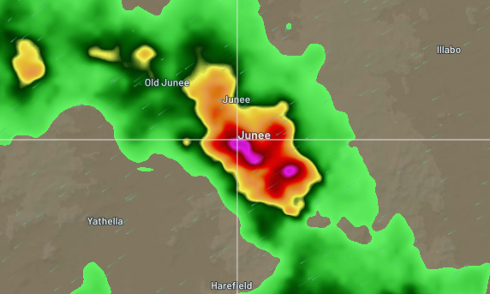
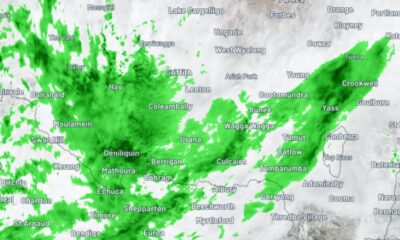
The thunderstorm as seen on weather radar at 9.20am on Saturday, December 13, 2025 | Photo: Weatherzone
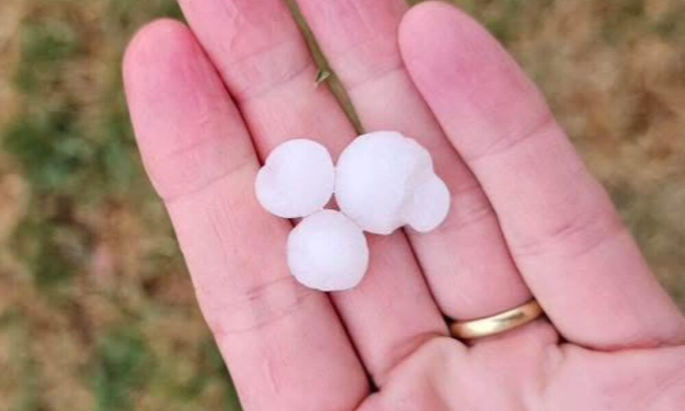
Photo: Kate Studento
The heaviest impacts were felt across the town’s southern and south-eastern fringes, where hailstones grew larger and fell more densely, blanketing backyards and garden beds in ice.
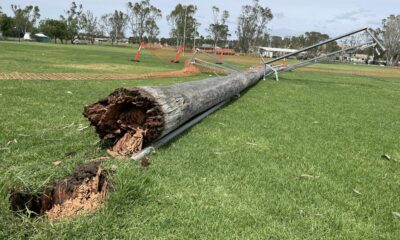
Photographs and videos sent to The Junee Bulletin show hail covering lawns like scattered pebbles, bouncing across patios and pooling alongside intense rainfall.
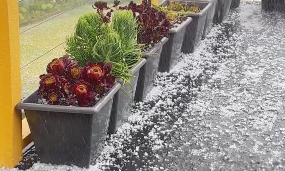
Photo: Merlinda Casapoa
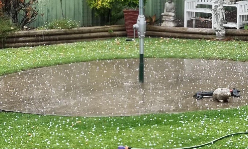
Photo: Shirley Eggleton
Widespread rainfall totals of up to 10 millimetres in 15 minutes were recorded in backyard rain gauges across Junee, highlighting the storm’s intensity despite its brief duration.
The Bureau of Meteorology had forecast the chance of thunderstorms across the region on Saturday, with the potential for some cells to reach severe thresholds later in the day.
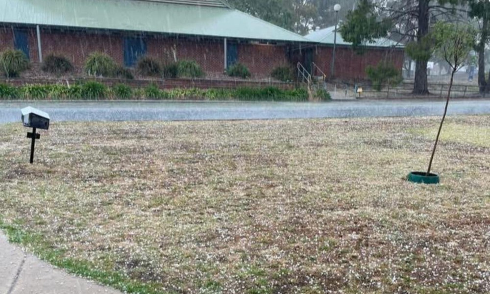
Photo: Nicole Vos

Photo: Merlinda Casapoa
While the broader forecast focused on the afternoon and evening, Saturday morning’s storm struck earlier than expected, catching many residents off guard.
Residents are urged to keep an eye on the weather radar and the Bureau of Meteorology’s website for any warnings that may be issued throughout the day.


Woman charged over alleged fraud at Commercial Hotel

New graduate nurses on the frontline at Junee Correctional Centre

Woman killed after car collides with tree in Riverina crash