
Local
Multiple tornados touch down near Young, Temora
A RARE tornado warning was issued for parts of the Riverina and South West Slopes on Wednesday, after multiple twisters were observed tearing through the region.
The Bureau of Meteorology first confirmed a tornado was observed on the ground north-west of Young, in the NSW South West Slopes region, at around 3.30pm, as a band of “very dangerous” storms pushed through the area.
There were no immediate reports of damage, with footage captured from a NSW Rural Fire Service lookout at Tubbul showing the tornado churning across open fields.
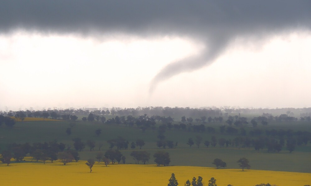
A tornado was observed north-west of Young at 3.30pm on Wednesday, September 10, 2025 | Photo: NSW RFS
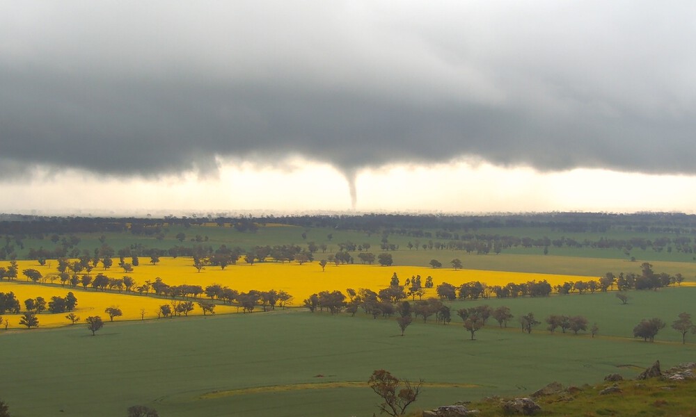
A tornado was observed north-west of Young at 3.30pm on Wednesday, September 10, 2025 | Photo: NSW RFS
The unusual sighting prompted the Bureau of Meteorology to issue a rare tornado warning for the area at 3:49pm.
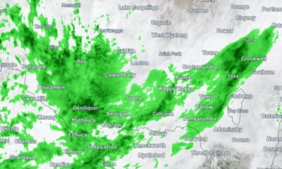
The warning covered parts of the Central Tablelands, Southern Tablelands, Central West Slopes and Plains, South West Slopes and Riverina Forecast Districts.
“VERY DANGEROUS THUNDERSTORMS are likely to produce tornadoes, destructive winds, large hailstones and heavy rainfall that may lead to flash flooding over the next several hours,” the warning read.
Young and Cowra were listed as towns that could be impacted, before the warning was downgraded at 4:32pm.
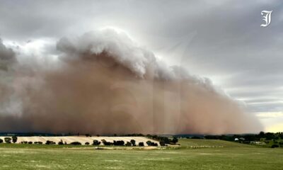
Meanwhile, a powerful tornado was also filmed carving through paddocks at Caragabal, about 80km north of Temora, in the NSW Riverina.
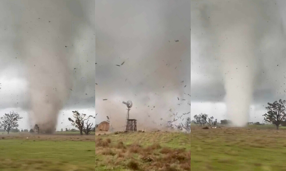
A powerful tornado was filmed tearing through paddocks at Caragabal | Photos: Neil Davies
The video shows the violent vortex obliterating everything in its path, including numerous sheds, as it cuts a path across multiple paddocks.
The footage, originally uploaded to Facebook by Neil Davies at 5pm on Wednesday, is being described as some of the most intense close-up vision of a tornado ever captured in Australia.
The Bureau of Meteorology said the immediate threat of tornados had passed, and severe thunderstorms were no longer occurring in the Riverina district.
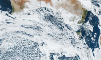
The agency says the wild weather is being triggered by a cold front attached to a low pressure system, which is moving eastwards through central parts of the state.
You can read the warning in full on the Bureau of Meteorology’s website, here.
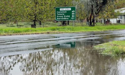
For emergency help in floods and storms, call the State Emergency Service (SES) on 132 500.


Man accused of decades-long rape and abuse to stand trial

Disqualified driver allegedly more than seven times the legal limit

Low-level bridge replacement on track for Christmas finish


